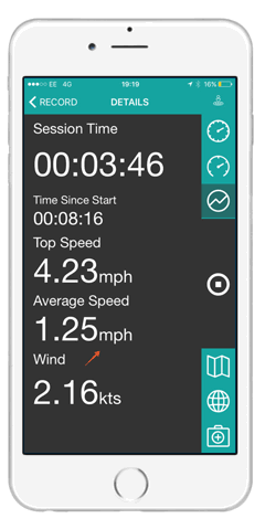
GeoSUP has the ability to record the following data throughout the duration of your paddle.
– Overall session time and actual paddling time with auto pause
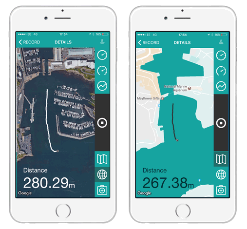
– Distance paddled
– Top speed, average speed & speed breakdown
– Live weather data including wind direction & speed
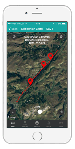
– Your paddling route
Track your paddle. GPS tracking will place you at your exact location regardless of whether or not you have phone signal. GeoSUP even works on airplane mode for those longer paddles . Choose from 2 map settings (satellite or outline) to clearly see your route.
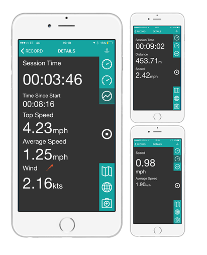
Use GeoSUP as a training tool by analysing the data on and off the water, to help improve your performance. All the info is there to allow you to get as techy as you want! 5 different record screens allows you to pick the one that suits you best.
Taking photos/videos during your paddle is easy with GeoSUP, with just one simple click on the home record screen. You can also see the location of all your media spots.
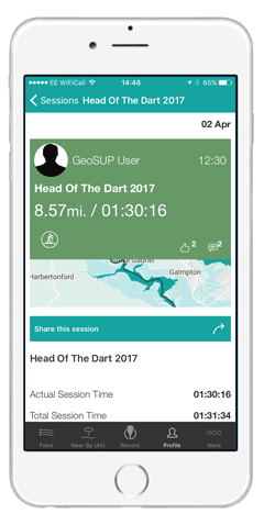
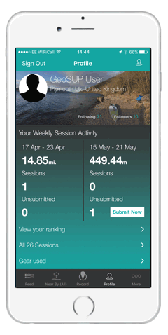
Save your paddles to your personal profile much like a SUP diary, to keep a log of your weekly/monthly/yearly session activity.
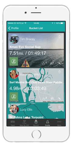
Create a bucket list in your personal profile to save your top most wanted paddles and locations. Get inspired for travel and adventure.
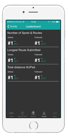
See how you rank to other paddlers around the world by comparing their on the water data.
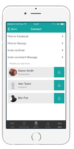
Connect with paddleboarders anywhere in the world via GeoSUP, Facebook and email, and see their SUP activity in your 100% SUP news feed.
Discover great new paddle locations by searching near by paddling spots, or look for paddling locations further afield with a simple spot search. Find a new paddling location every day!

Share your SUP paddles, experiences and local knowledge with other paddlers by submitting your paddle to GeoSUP. Together lets make the paddlers guide to the globe.